
NSW is being hit by a one-two of east coast lows. But aren't those a winter thing?
- Written by Milton Speer, Visiting Fellow, School of Mathematical and Physical Sciences, University of Technology Sydney
It was Western Sydney’s turn for a drenching this week, as the region was hit by an east coast low – the infamous storm systems that periodically bring heavy rainfall to the New South Wales coast.
This east coast low was created by the same persistent band of low atmospheric pressure that generated a series of thunderstorms that soaked Brisbane and Lismore during the preceding days, delivering daily rainfall totals greater than 250 millimetres to Southeast Queensland and the NSW Northern Rivers.
The east coast low then formed on Tuesday, dumping more than 100mm of rain on western Sydney and the nearby ranges.
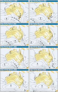
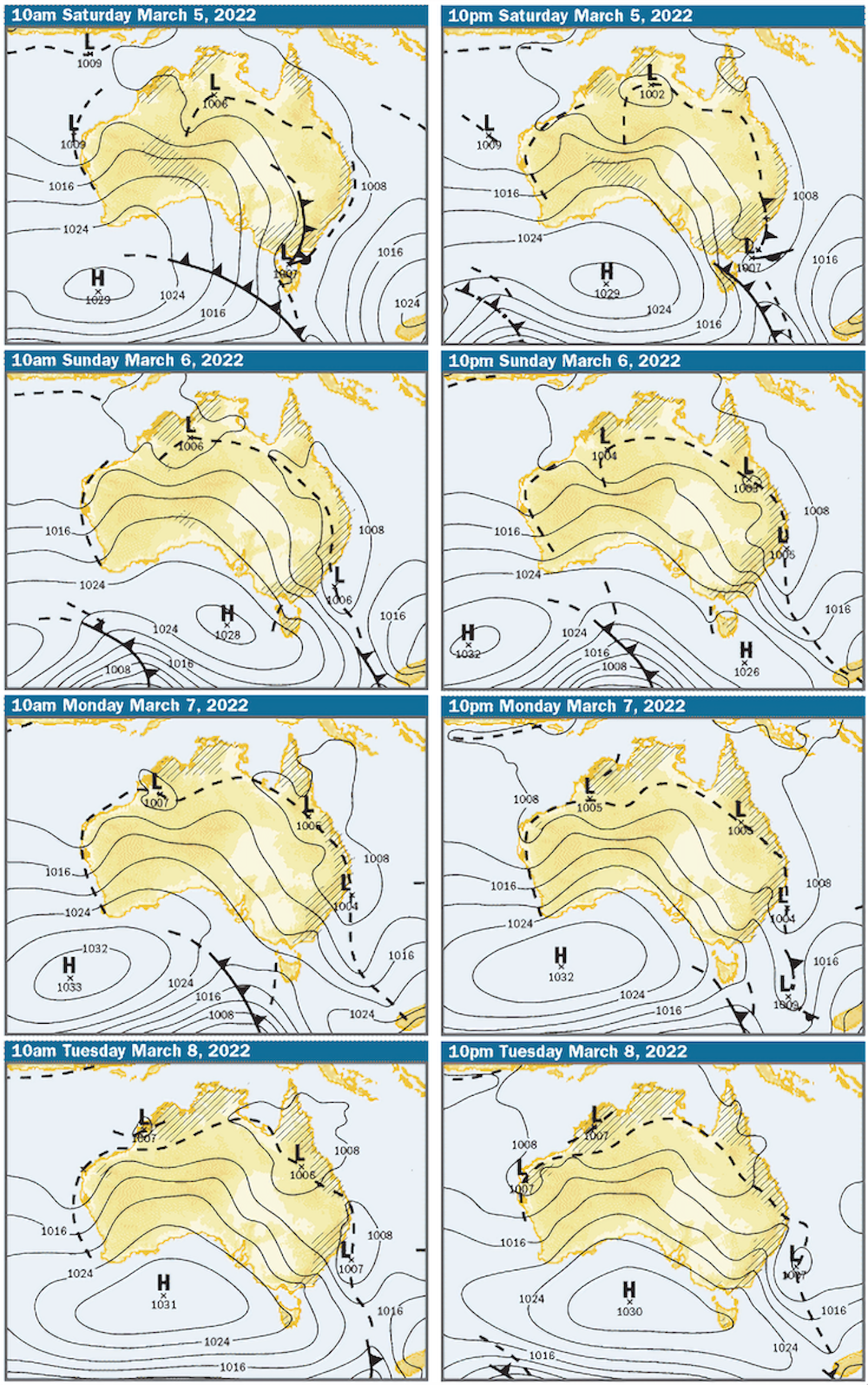
And this low pressure trough isn’t done yet. It’s forecast to create a second east coast low that will develop over the weekend and affect the NSW south coast, bringing rain that could once again extend to the greater Sydney area and also to to the Hunter region.
The remarkable persistence and geographical spread of these rain systems prompts several questions. Why did the first east coast low form, even after so much rain had already fallen on Brisbane and Lismore? Why is a second east coast low poised to form further to the south? And why are these systems, more commonly thought of as a winter phenomenon, happening at the tail end of summer?
How and when do east coast lows form?
East coast lows typically form one at a time. But it’s not that unusual for a particularly large area of low atmospheric pressure to spawn several of these storm systems, either one after another, or sometimes even simultaneously.
As we’ve already described, the precursor to the formation of an east coast low is typically a low pressure trough, similar to the one that has been positioned near Brisbane and northern NSW for more than a week.
A low pressure trough is an elongated region of low atmospheric pressure, and on Australia’s east they typically run alongside the coast. They are often an indicator of coming clouds, showers or, given enough atmospheric moisture, very heavy showers or thunderstorms.
Read more: Stalled weather: how stuck air pressure systems drive floods and heatwaves
Combined with the high moisture content in the atmosphere over coastal eastern Australia, due partly to the influence of La Niña this summer, the resulting flood rainfall was focused close to the trough. The fact that the trough has remained almost stationary for an extended period of time has meant continuous rainfall for Southeast Queensland and the NSW Northern Rivers.
Eventually, the low pressure trough moved east on Tuesday and a weak low pressure centre developed well to the east of Brisbane, over the Tasman Sea. As the low pressure centre developed and moved slowly towards the NSW coast on Wednesday, the moist, southeast winds on the southern side of the low concentrated the rain onto the eastern side of the Great Dividing Range, north of Sydney.
The low pressure centre finally weakened on Thursday. But a second east coast low is forecast to form during Sunday near the southern half of the New South Wales coast, resulting in more coastal rain spreading as far north as the Hunter region.
Do they eventually move on?
These low pressure systems tend to dissipate in a matter of a day or two, unless other nearby atmospheric conditions prolong their survival. At this time of year, they need to be reinforced by cold fronts moving from west to east, immediately to Australia’s south.
Such frontal systems have been absent in recent months, enabling the very moist air to remain in place over most of eastern Australia.
A contrasting sequence of the persistent easterly airflow has been its impact on southwestern Australia. The easterly winds have shed their moisture during their passage over southern Australia. Hence, they reach southwestern Australia as a hot, dry air mass. It’s no coincidence that Perth has just smashed its record for the number of days above 40℃ in a summer.
Is this normal for this time of year?
East coast lows can form in any month of the year, although they tend to happen mostly in the cooler months of April to September. Some devastating east coast lows have formed during warmer months, including the one that hit the Sydney to Hobart Race in December 1998, claiming six lives and sinking five yachts.
Read more: Explainer: the wild storms that lash Australia's east coast
It is hard to assess whether climate change has had an influence on the frequency of warm-season east coast lows. However, rising average sea surface temperatures could conceivably be a contributing factor to any change in their frequency.
For the more common cool-season east coast lows, however, we already know their development has shifted further south and east since the 1990s. This is consistent with the predictions of climate models that global warming will push mid-latitude westerly winds further towards the poles.
As this process continues, those east coast lows that develop in a westerly wind regime are likely to shift further poleward or become less frequent if conditions become less conducive to their formation, as suggested by recent research.
But these ferocious weather systems will nevertheless continue to be a threat to Australia’s east coast. Even if the rain doesn’t make landfall, east coast lows can generate large waves that disrupt otherwise benign sea conditions, such as in January 2021, when three people were tragically killed at Port Kembla.
Authors: Milton Speer, Visiting Fellow, School of Mathematical and Physical Sciences, University of Technology Sydney