
Modern Australian
The Times

New satellite data shows NZ’s major cities are sinking – meaning rising seas will affect them sooner

  • Written by Jesse Kearse, Postdoctoral Researcher, Geophysics, Kyoto University
New satellite data shows NZ’s major cities are sinking – meaning rising seas will affect them sooner

Rising seas are already affecting coastal communities in Aotearoa New Zealand. On a global average, the sea level is now 18 centimetres higher than it was in 1900, and the annual rate of increase has been accelerating to currently 4.4 millimetres per year.

This may not seem much, but it is already amplifying the impact of storm and tidal surges. Over the coming decades and centuries, this will pose increasingly serious problems for all coastal communities.

But this is not the end of our troubles. Some parts of New Zealand’s coastline are also sinking. In many New Zealand cities, shorelines are steadily subsiding, with growing impacts on coastal infrastructure.

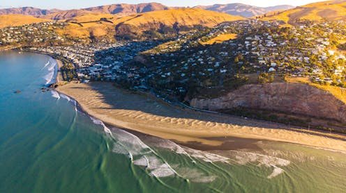
Our new research reveals where and how fast this is happening. We found the coastlines near all major cities in New Zealand are sinking a few millimetres each year, with some of the fastest rates in coastal suburbs of Christchurch, where the land is still adjusting to the impact of the 2011 earthquake.

Relative increase in sea level

Sea-level rise is happening globally because the ocean is expanding as it continues to warm and glaciers and polar ice sheets are melting.

Meanwhile, land subsidence operates on regional or local scales, but it can potentially double or triple the effects of sea-level rise in certain places. This dual effect of rising seas and sinking land is know as relative sea-level rise and it gives coastal communities a more accurate projection of what they need to prepare for.

To understand which parts of the coast are most at risk requires detailed and precise measurements of land subsidence. The key to this is to observe Earth from space.

We have used a technique known as interferometric synthetic aperture radar (InSAR). This involves the repeat acquisition of satellite radar images of the Earth’s surface, tied to very accurate global navigation satellite system measurements of ground stations.

This builds on earlier work by the NZSeaRise project, which measured vertical land movement for every two kilometres of New Zealand’s coastline. Our study uses a significantly higher resolution (every ten metres in most places) and more recent datasets, highlighting previously missed parts of urban coastlines.

Urban hotspots

For instance, in Christchurch the previous NZSeaRise dataset showed very little subsidence at Southshore and New Brighton. The big differences in the new data are not due to the increase in spatial resolution, but because the rate of vertical land movement is very different from the time prior to the 2011 earthquake.

Localised subsidence in these Christchurch suburbs is up to 8mm per year, among the fastest rates of urban subsidence we observed. These areas sit upon natural coastal sand dunes above the source area of the earthquake and the Earth’s crust is still responding to that sudden change in stress.

A map of subsidence in Christchurch. Circles dotted around the coastline show NZSeaRise estimates (2003-2011), blue circles show results of this study (2018-2021).
This map shows vertical land movement (VLM) in Christchurch, highlighting areas that are sinking. The circles around the coastline show NZSeaRise estimates (2003-2011) and continous blue shading highlights new results (2018-2021). Jesse Kearse, CC BY-SA

We have tracked vertical movement of the land with millimetre-scale precision for five major cities in New Zealand. The InSAR technique works particularly well in urban areas because the smooth surface of pavements, roads and buildings better reflects the satellite radar beam back into space where it is picked up by the orbiting satellite.

This means the estimates of relative sea-level rise for these cities are close to or above 7mm per year. If sustained, this amounts to around 70cm of sea-level rise per century – enough to seriously threaten most sea defences.

Our new satellite measurements provide a detailed picture of urban subsidence, even within single suburbs. It can vary by as much as 10mm per year between parts of a city, as this map of Dunedin and the Otago Harbour shows.

A map of urban land subsidence in Otago Harbour and Dunedin city. The darker blue colours show where land is sinking at a rate of 4mm per year or more.
This map shows vertical land movement (VLM) in Dunedin. The darker blue colours highlight parts of the city where land is sinking at a rate of 4mm per year or more. Jesse Kearse, CC BY-SA

We found hotspots of very rapidly sinking regions. They tend to match areas of land that have been modified, particularly along the waterfront. During the 20th century, many acres of land were reclaimed from the ocean, and this new land is still compacting, creating an unstable base for the overlying infrastructure.

One example of this is in Porirua Harbour, where a section of reclaimed land near the mouth of Porirua Stream is sinking at 3–5mm per year. This is more than double the average rate for Porirua’s coast.

Two maps showing the outline of reclaimed land in Porirua Harbour and the level of subsidence.
Rapidly sinking regions often match areas of land that have been modified or reclaimed, such as along the waterfront of Porirua Harbour. Jesse Kearse, from http://retrolens.nz, licensed by Land Information NZ, CC BY-SA

Paradoxically, perhaps, it is only by looking back on our planet from outer space that we can begin to see with sufficient detail what is happening to the land in our own backyard.

The good news is that we can use the results to identify coastlines that are particularly vulnerable to sea-level rise and plan accordingly for any future development. Our new measurements are just the first step in what must become a major effort to watch the ups and downs of our coastlines and urban areas.

Authors: Jesse Kearse, Postdoctoral Researcher, Geophysics, Kyoto University

Read more https://theconversation.com/new-satellite-data-shows-nzs-major-cities-are-sinking-meaning-rising-seas-will-affect-them-sooner-252881

The Growing Popularity of Lab Grown Diamonds in Sydney and Hong Kong

The diamond industry has changed significantly in recent years as more buyers seek ethical, affordable, and sustainable alternatives to mined diamon...

Modern AI SEO Agency vs Traditional SEO: What’s the Difference

Search engine optimisation has changed dramatically over the past few years. Search engines have become smarter, user behaviour has evolved, and bus...

Caravan Travel for Modern Australian Getaways: Plan a Comfortable Holiday

A family road trip is one of the best ways to explore Australia together. And, travelling by caravan gives you the freedom to take your time, stop a...

Mini Excavator and Trailer Package for Sale: What I Buy as One Deal in 2026

The first client who asked me for a mini excavator and trailer package for sale wasn’t trying to save a few hundred dollars on shipping. They we...

Make Dad a Guest in His Own Home This Father’s Day

Father’s Day can accidentally turn Dad into the unpaid event manager of his own celebration. He lights the barbecue, finds extra chairs, checks wh...

Where to Enjoy Your Off-Road Caravan on the Gold Coast

With a caravan, you can travel anywhere and everywhere without battling the rush of the peak holiday season or last-minute reservations. While the r...

How Osteopathy Supports Recovery from Sciatica and Nerve Pain

Sciatica isn't just annoying. It's genuinely painful. It sits deep in your glute and shoots straight down the back of your leg. It turns something as...

The Winter Jewellery Edit: Five Pieces You'll Wear All Season

As wardrobes shift to cosy knits, tailored coats and rich seasonal textures, jewellery becomes the finishing touch that pulls every winter outfit to...

7 Signs It's Time to Upgrade Your Piston Air Compressor

If you run a workshop, panel shop, or fabrication business anywhere around Perth, you already know what heat and dust do to equipment over a few sum...

How Long Do Bathroom Renovations Melbourne Take? Step-by-Step Process Explained

Planning a bathroom renovation is exciting, but one of the biggest questions homeowners ask is, "How long will it take?" While every project is uniq...

Why Your Skin Breaks Out: The Science of Acne Explained

Acne is the most common skin condition in the world. An estimated 85% of people experience it at some point between the ages of 12 and 24, and a gro...

10 Swimwear Trends Australian Women Are Wearing This Summer

Every Australian summer brings a fresh wave of swimwear trends, but some styles have much greater staying power than others. While fashion constantly ...

Why Regular Skills Updates Are Essential for Licensed Security Officers

A guard at a Brisbane shopping centre gets a call about a shoplifter who's turned aggressive.  They’ve done the job for six years. But their de-...

10 Benefits of Choosing Professional Tutoring Penrith Services

Every student has unique learning strengths, challenges, and academic goals. While classroom teaching provides essential knowledge and structure, so...

Sunshine Coast Baby Classes Prove Big Hit Among First-Time Mums

There's a movement gaining traction on the Sunshine Coast, providing a village of support, socialisation and relief for first-time mothers and babie...

Father's Day Gift Ideas for Men Who Are Hard to Buy For

Some dads are easy to buy for. Others do not want anything, already have everything, or give you the classic "don't worry about me" answer every yea...

Top 5 Mistakes That Wear Out Your Brakes Faster

Brakes don't need frequent replacements like oil changes do.   But a lot of the wear happens quietly, over months, because of habits most drivers...

Plantation Shutters vs Curtains: Which Is Better for Your New Home?

Moving into a new home is an exciting opportunity to personalise your space and make it your own. While many homeowners focus on furniture, flooring...